Kalimantan Maps and Orientation
(Kalimantan, Indonesia)
Located on the island of Borneo, Kalimantan is home to a population of approximately 12 million people. Kalimantan forms the main southern region and encompasses some 70% of Borneo, while to the north, both East
Malaysia and Brunei are to be found.
Since Kalimantan covers such a vast area, getting around can be quite difficult and time consuming, and tours prove to be popular with holiday makers. There are three main ethnic groups residing here - the Malay Indonesians, the Chinese, and the indigenous Dayak tribes.
Maps and Orientation of the Island
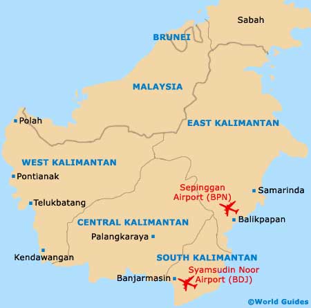
This Indonesian region is divided into a total of four very individual provinces:
- East Kalimantan - home to the cities of Balikpapan and Samarinda
- West Kalimantan - with Pontianak being the capital city
- Central Kalimantan - rather dominated by the Dayak people, with Palangka Raya (Palangkaraya) serving as the provincial capital
- South Kalimantan - featuring 11 regencies and two cities, Banjarbaru and Banjarmasin
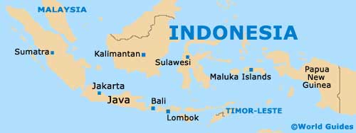
The following destinations are relatively close to Kalimantan and shown with their respective directions:
- Bali - south
- Bangka - west
- Belitung - west
- Brunei - north
- East Malaysia - north
- Java (capital Jakarta) - south
- Lombok - south
- Maluku Islands - east
- Riau Islands - west
- Sabah (Malaysian state) - north
- Sulawesi - east
- Sumatra - west
Map of Indonesia
Map of Kalimantan